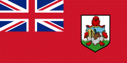
Pembroke Parish (Pembroke Parish)
Pembroke Parish is one of the nine parishes of Bermuda. It is named after English aristocrat William Herbert, 3rd Earl of Pembroke (1580–1630).
It occupies most of the short peninsula which juts from the central north coast of Bermuda's main island, and surrounds the city of Hamilton on three sides (the fourth being taken up by the shore of Hamilton Harbour). As such, its shape bears some passing resemblance to the county of Pembrokeshire in Wales. The peninsula juts into the eastern side of the Great Sound, the large expanse of water which dominates the geography of western Bermuda. In the east, Pembroke meets Devonshire Parish. As with most of Bermuda's parishes, it covers just over 2.3 square miles (about 6.0 km2 or 1500 acres). It had a population of 11,160 in 2016.
Natural features in Pembroke include Spanish Point, and Point Shares, as well as numerous small islands off Point Shares.
Other notable features of Pembroke include Fort Hamilton and Government House.
Pembroke Marsh East was designated a Ramsar site on 11 May 1999.
Map - Pembroke Parish (Pembroke Parish)
Map
Country - Bermuda
 |
 |
Bermuda is named after Spanish explorer Juan de Bermúdez, who discovered the archipelago in 1505. The islands have been permanently inhabited since 1612, and, forming part of British America, became a crown colony in 1684. The first African slaves arrived in 1616, but as the slave trade ceased by the end of the 17th century, the colony developed into a base for merchants, privateers, and the Royal Navy. More recently, tourism has been a significant contributor to Bermuda's economy. After World War II the territory became an offshore financial centre and tax haven.
Currency / Language
| ISO | Currency | Symbol | Significant figures |
|---|---|---|---|
| BMD | Bermudian dollar | $ | 2 |
| USD | United States dollar | $ | 2 |
| ISO | Language |
|---|---|
| EN | English language |
| PT | Portuguese language |


